Penrith City Local History - Places - Suburb profiles - Claremont Meadows
Claremont Meadows
Claremont Meadows is bounded by the Great Western Highway, Gipps Street, Caddens Road and the University of Western Sydney Nepean. The suburb of St Marys is the eastern boundary with Werrington at its northern border. The suburb of Kingswood is on its western end and the rural suburb of Orchard Hills runs along its southern boundary. Claremont Meadows was opened for residential developments in 1984, and has grown steadily since. Claremont Meadows is centrally located to take full advantage of the tertiary facilities within Penrith, as well as the shopping centres of both St Marys and Penrith.
Claremont Meadows on Google Maps
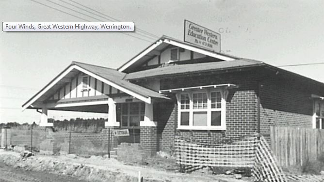
Four Winds: Four Winds is a brick bungalow, built in 1922 for a successful local tanner, Martin Brell. The tannery was located on the eastern side of the house, towards South Creek and some of the tanning pits are believed to remain on this site. It has since been used by the Greater Western Education Centre. In 2006 the house was owned by the NSW Government.
| 1885 | 19 April | Bryan Molloy of Claremont died |
| 1885 | Claremont subdivided after Bryan Molloy dies | |
| 1984 | Claremont Meadows Housing Estate was released for development | |
| 1994 | Neighbourhood centre opened | |
| 1995 | November | Claremont Meadows Social Plan completed |
| 1998 | 27 January | Claremont Meadows Primary School opened |